Basic statistics
New Mexico is bordered by:
- Colorado on the north,
- on the south by Texas and Mexico,
- by Oklahoma and Texas on the east, and
- on the west by Arizona.
New Mexico covers 121,598 square miles, making it the 5th largest state of the 50 states.
New Mexico’s land area is 121,365 square miles.
New Mexico’s water area is 234 square miles.
According to the 2009 census New Mexico’s population is 2,000,671.
The highest point in New Mexico is Wheeler Peak at 13,161 feet above sea level. Wheeler Peak is located in the Sangre de Cristo mountain range, which is the southern most point of the Great Rocky Mountain range out of Colorado.
The lowest point in New Mexico is 2,842 feet above sea level at the Red Bluff Reservoir.
The mean elevation of the state is 5,700 feet above sea level.
The Land
The state consists of four land regions – the Great Plains, the Colorado Plateau, the Rocky Mountains, and the Basin and Range region.
The eastern third of New Mexico is covered by the Great Plains. The Great Plains run from a high plateau in the north to the Pecos River in the south . Rivers in the high plateau have cut deep canyons into the landscape. This area is used for sheep and cattle ranches. To the south dry farming and irrigated agriculture is possible. South of the Canadian River, along the eastern edge of New Mexico, the land is referred to as the High Plains or Staked Plains (Llano Estacado). Steep escarpments or rocky formations on the east, north and western boundaries of the Llano Estacado probably account for it name. The five counties the five counties included in the "High Plains" geography are:
- Union County and the town of Clayton,
- Quay county and Tucumcari,
- Curry county and the town of Clovis,
- Chaves county and the city of Roswell, and.
- Lea County and the cities of Tatum, Lovington (the county seat), Hobbs, Eunice, and Jal.
The Colorado Plateau, to the northwest, is a rugged area of wide valleys, deep canyons, sharp cliffs, and flat-topped hills called mesas. The Continental Divide runs through the Colorado Plateau. Streams west of the Divide drain into the Pacific Ocean. Those to the east run to the Gulf of Mexico.
 The north central section of New Mexico is covered by a series of mountain ranges that are part of the Rocky Mountains. The Rio Grande River cuts through the Rocky Mountains from north to south. East of the Rio Grande, is the Sangre de Cristo (Blood of Christ) Mountain range.
Wheeler Peak, the highest point in New Mexico is found in this range. To the west of the Rio Grande are the Nacimiento and Jemez Mountain ranges. Melting snows from the Rockies provide moisture each spring for irrigated crops in the Rio Grande Valley.
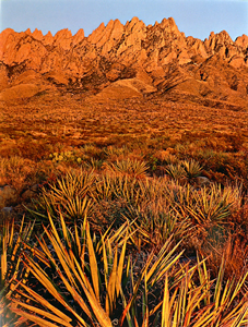
 The Basin and Range Region cover about one third of the state and lies to the south of the Rocky Mountain Region. This region extends south from around Santa Fe to Mexico and west to Arizona. This area is marked by rugged mountain ranges, such as the Guadalupe, Mogollon, Organ, Sacramento, and San Andres mountain ranges, separated by desert basins. The Rio Grande River flows south to form the border between Texas and Mexico.
